 |
|
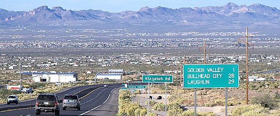
| Arizona State Route 68 crosses the broad Sacramento Valley passing through Golden Valley, then proceeds up and over the Black Mountains through Union Pass and down into the valley below to Bullhead City and Laughlin. |
|
| State Route 68, also known as SR 68, is an east–west highway in northwestern Arizona running from its western terminus at its junction with State Route 95 in Bullhead City to a grade-separated interchange at U.S. Route 93 northwest of Kingman. |
 |
| Heading into the Sacramento Valley, home of Golden Valley |
 |
 |
| Truck weigh station at the east side of the valley. |
 |
 |
| This is the Golden Valley, State Route 68 exit if your on US 93 |
 |
 |
| Looking southwest from State Route 68 |
 |
 |
| Looking southeast with the Hualapai Mountains in the far distance. |
 |
 |
| Looking northwest toward the Black Mountains. The Black Mountains of northwest Arizona are an extensive, mostly linear, north-south 75-mile long mountain range. It forms the north-south border of southwest Mohave County as it borders the eastern shore of the south-flowing Colorado River from Hoover Dam. |
 |
|
|
|
|