 |
Arizona State Highway 68 connects Kingman and Bullhead City, passing through Golden Valley. Golden Valley is great place to live and is manufactured home friendly for affordable retirement living. The Colorado River with great fishing and recreation is just a few miles away, as is gambling in Laughlin. |
 |
|
 |
Arizona State Highway 95 has two sections in Mohave County. It is a north–south state highway along the western edge of Arizona that is split into two sections. The first is South of I-40 which takes you to Lake Havasu City & Lake Havasu. The second is from Bullhead City south to Colorado River. |
|
|
 |
SR 389 is a 32 mile highway located in the Arizona Strip that connects the two cities of Colorado City and Fredonia. Many people travel across it to reach the North Rim of Grand Canyon National Park. |
|
|
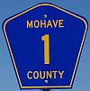 |
Mohave County 1 begins at Golden Shores and ends at Mohave County 227. A short drive across Mohave County 227 brings you to Arizona Highway 95 which will take you to Bullhead City |
|
|
 |
Oatman Road - The community of Oatman is a must see as you travel in the southwest. Scenes from "How The West Was Won" were filmed there. The area scenery is true old west. Oatman Topac Road - Early travelers were happy to see this flatter land but crossing the Colorado River was next. |
|
|
 |
Alamo Road - Begins at Exit 25 on I-40 and goes south to Alamo Lake. This also the road you take to the junction of Chicken Springs Road which goes to Wikieup, Arizona. The first thing you will encounter is the huge dome sometimes called the Golf Ball House, also called the Space Station House. |
|
|
 |
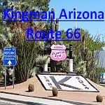
Stockton Hill Road - Begins in Kingman at Andy Devine Avenue, also known as Historic Route 66. It is the primary north-south business corridor in Kingman. It has Exit 51 on I-40 where 25,000 vehicles a day pass through. Stockton Hill Road continues north for about 40 miles to Mohave County 25. |
|
|
 |
Pierce Ferry Road starts on US 93 at mile post 42 and goes to Dolan Springs and Meadview with access to Lake Mead at South Cove. Pearce Ferry marks the boundary between Lake Mead and the west end of the Grand Canyon.You can also get to the Skywalk and Grand Canyon Ranch from this road. |
|
|
 |
Mohave County Highway 68 starts at Arizona 68 and goes to Davis
Dam and Katherine Landing. From Katherine Landing you can enjoy Lake Mohave's 242 miles of shoreline with many sandy beaches and secluded coves to explore for swimming, water skiing, scuba diving, boating and fishing. |
|
|
 |
Mohave County Highway 125 starts on US 93 and goes to Chloride. Chloride is the oldest continuously inhabited mining town in the state of Arizona. A few miles off the main highway and many miles back in time, you can even star in your own western movie in Chloride. |
|
|
 |
Chicken Springs Road - Mohave County 131 runs between US 93 and Alamo Road. Alamo Road then connects you to I-40 at Exit 25. The road is county maintained gravel, normally in good condition. This road passes through the The Bar S Ranch,a cattle ranch covering over 250 square miles (160,000 acres). |
|
|
 |
Cottonwood Road - Begins at US 93 milepost 46 and goes west to Lake Mohave and provides great fishing access.It is 19 miles of well maintained gravel road from the highway to the water's edge. This is primarily fishing access, but there is no launch ramp for boats. |
|
|
 |
Hackberry Road - Also known as Mohave County road 141 is a twenty-one mile smooth dirt road across the Arizona back country from US 93 just south I-40 to Historic Route 66 near the town of Hackberry, Arizona on Historic Route 66. |
|
|
 |
Temple Bar Road - The drive to Temple Bar from US 93 is the wide open spaces. The marina at the end of the road is a very popular place. Temple Bar provides perfect weather for enjoying outdoor activities from hiking to boating to wildlife viewing. |
|
|
 |
Hualapai Mountain Road - Begining at Andy Devine Avenue, Historic Route 66, Hualapai Mountain Road is a 16 mile long paved road that climbs from Kingman, Arizona to the crest of the rugged Hualapai Mountains. Enjoy the beauty of Hualapai Mountain Park. |
|
|
 |
Antares Road - Begins at Route 66 and heads northwest for over 50 miles towards Pierce Ferry road which is the road to Meadview and Lake Mead access. Features of interest along the way include Red Lake, a colorful dry lake bed, and large forests of Joshua trees around the north end of the road. |
|
|
 |
Mineral Park Road - Mineral Park Road leads back to a huge copper and molybdenum mine. There is no town of Mineral Park anymore. The Mineral Park area contains the world's largest turquoise deposit (not open to the public). Decorative rock and gravel are also mined. |
|
|
 |
Diamond Creek Road - An Indian Nation Road on the Hualapai Indian Reservation. Over its 21 miles, Diamond Creek Road drops from an elevation of 4,798 feet at Peach Springs, to 1,343 feet at the Colorado River. The road is rough, 4 wheel drive is recommended, and think of this trip as an adventure! |
|
|
 |
National Old Trails Road - Early trails were not usually linked to road improvements, though counties and states often prioritized road improvements because they were on trails. In Mohave County Arizona the National Old Trails Road was a forerunner of Route 66. |